
Elevated Severe Weather Threat Wednesday Evening – Early Overnight
- FirstWARN Tri-Cities Staff

- Mar 10
- 1 min read


An elevated threat for a few strong to severe thunderstorms is expected between 7 PM Wednesday and 1 AM Thursday. All modes of severe weather are possible.
Main Threat: Damaging wind gusts
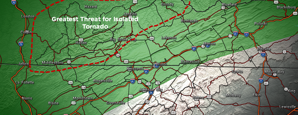
Secondary Threats: An isolated tornado or small hail
The greatest tornado risk appears to be near the KY/VA line.
Storms are expected to move west to east across the region in a line, with approximate timing:
7–10 PM: Western counties
9 PM–Midnight: Tri-Cities
11 PM–1 AM: Eastern areas
These timing estimates could still change, so check back for updates Wednesday morning.
After the Cold Front Passes:
Some brief snow showers are possible in the mountains and parts of Southwest Virginia, with flurries possible around the Tri-Cities. Any accumulation would be very light and mainly on grassy surfaces.
Make sure you have multiple ways to receive warnings Wednesday evening and stay tuned for updates as we continue to monitor this system. We will be LIVE during severe weather alerts Wednesday evening / night.


Comments