
WEATHER ALERT DAY: Significant Winter Storm / Possible Ice Storm
- FirstWARN Tri-Cities Staff

- Jan 23
- 1 min read


A significant winter storm, with a possible ice storm, is becoming more likely for the Tri-Cities from Saturday afternoon through mid-afternoon Monday.
Saturday - Monday remains a FirstWARN Tri-Cities Weather Alert Day for a high-impact winter storm beginning after noon on Saturday and lasting into Monday afternoon. Remember, winter storms in our region are not just about snow, ice is expected to be a major impact with this system. Just because you don't see as much snow doesn't mean this is not a high impact storm.
Current Timeline:
•Saturday (Noon–4 PM): Precipitation begins as snow
•Saturday evening into overnight: Transition from south to north to sleet and freezing rain
•Early Sunday morning: Freezing rain continues
•Sunday: Mostly cold rain
•Sunday night through Monday mid-afternoon: Snow on the backside of the system
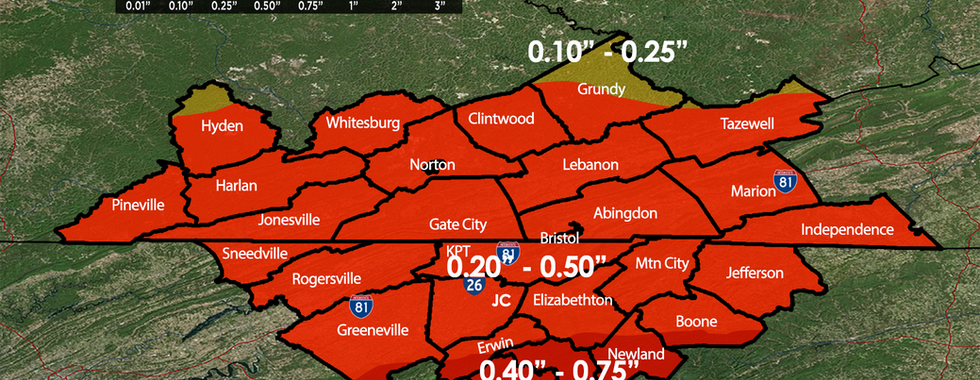
Ice Accumulation:
•Tri-Cities: 0.20" to 0.50" of ice possible
•Higher amounts possible in Western North Carolina
These amounts could lead to hazardous travel, scattered power outages, and downed tree limbs.
Downsloping winds off the mountains may keep immediate foothill locations on the lower end of the ice range. Due to these winds, a High Wind Warning is in effect for the mountains of East Tennessee.
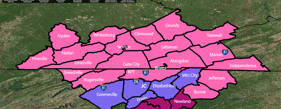
Winter Storm Warnings, Ice Storm Warnings, and Winter Weather advisories remain in effect for the region.
We will continue to closely monitor and refine the forecast and provide frequent updates and live coverage throughout the event. Now is the time to prepare for ice storm impacts and continue checking back for the latest information from FirstWARN Tri-Cities.


Comments