
Winter storm threat increasing Friday afternoon - Saturday night
- FirstWARN Tri-Cities Staff

- Jan 28
- 2 min read


A winter storm threat is increasing for Friday afternoon through Saturday night across the region. Confidence continues to rise as we are now within 36 hours of the start of this event, and model trends continue to support accumulating snowfall for much of the area.
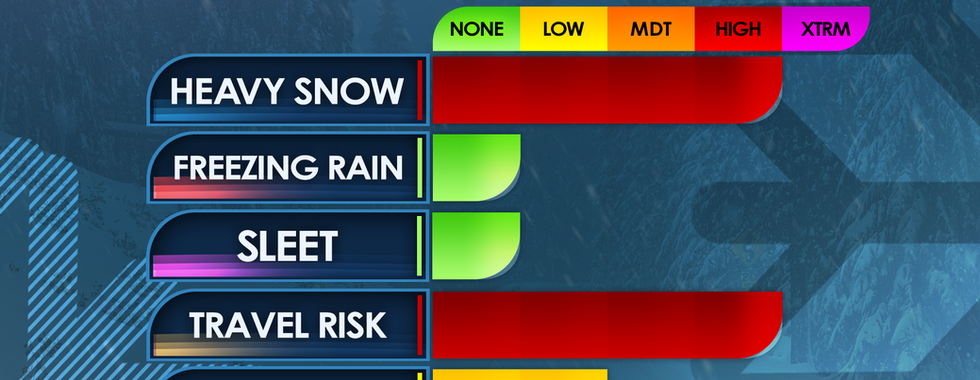
The main impacts with this system will be snow and hazardous travel. No mixing is expected, and the power outage threat remains low as this will be a dry, powdery snow. Temperatures will be extremely cold, especially Friday night and Saturday, allowing snow-to-liquid ratios of 15:1 to 20:1, meaning it will not take much precipitation to produce significant snowfall totals.
Timing:
Travel conditions could begin to deteriorate as early as late morning Friday in northern Southwest Virginia.
Early to mid-afternoon Friday for the Tri-Cities.
Snow is expected to begin in the Tri-Cities between 12 PM and 6 PM, with 2–4 PM being the most likely start window.
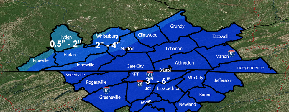
Snow Totals:
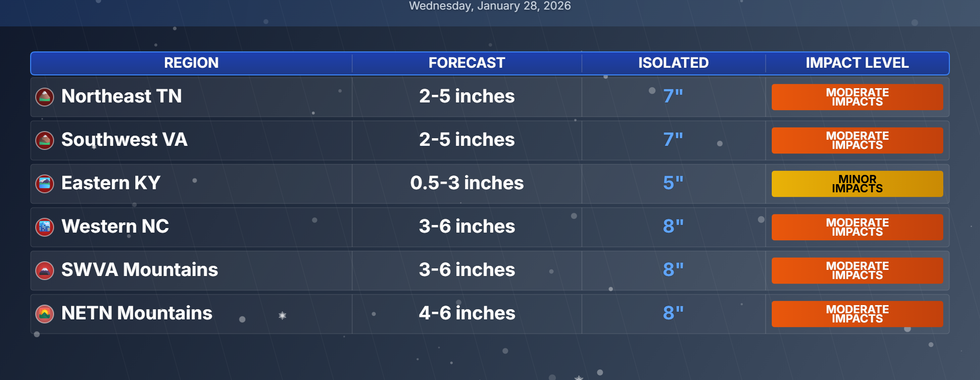
Our FirstCALL snow forecast has 3–6 inches across much of the region, including the Tri-Cities metro.
Amounts may decrease slightly farther west due to proximity to the coastal low.
Cold & Extended Impacts:
Highs Saturday only in the teens.
Highs Sunday in the low 20s.
These low temperatures combined with our snow totals could lead to hazardous travel all weekend.
Winter Storm Watches are likely to be issued overnight, with upgrades to warnings possible Friday.
School early dismissals are possible, but we will not speculate or answer questions regarding individual school systems. We will have a post at the top of our Facebook page Friday tracking any closings or dismissals.
Stay with FirstWARN Tri-Cities for frequent updates as we continue to track this developing winter storm closely.


Comments